AGCO Launches Free Operational Planning Tool for Farmers in Western Europe

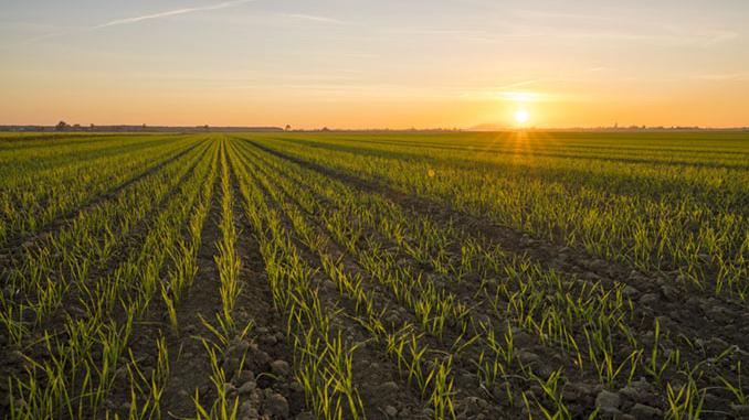
Geo-Bird operational planning tool offers farmers a free way to improve the efficiency of their operations with optimized guidance waylines. Photo: Business Wire.
AGCO Corporation has announced that it has launched a brand-new online tool called Geo-Bird that will help farmers around the world independently plan and optimize their global navigation satellite system (GNSS) machine guidance lines. After a period of pre-release testing and gathering maximum end-user feedback, this application is now available.
The number of turns a farmer must make in the tractor and the amount of fuel used to work a field is determined greatly by the wayline approach. While various methods can be used to generate efficient waylines in the cab, many farmers have expressed a desire to generate more efficient waylines out of the cab and in the off-season from the comfort of their office.
“The ability to plan in advance and outside the rush of narrow windows to complete fieldwork is very important to our customers,” explained Mark Theuerkauf, Fuse Go-To-Market Lead. “This is especially true when working on rented land, working as a contractor on many different fields, or growing specialty crops in combination with challenging local conditions, like irregular or sloping fields. It is often guesswork to know what the most efficient working direction should be.”
Geo-Bird is an easy-to-use application that can help farmers overcome this challenge. With minimal inputs, advanced algorithms inside Geo-Bird analyze the field shape and by considering matching working widths of implements, calculate the optimal wayline routing. Three potential routing suggestions are calculated, and also a manual direction can be entered for comparison.


Of each calculated routing, the time savings, wheel traffic area and the number of turns are shown, conveniently arranged to easily see the differences and potential savings.
Following the Fuse open platform philosophy, the desired routing can be downloaded in the right format for direct use on the farmer’s terminal in the cab, simply by choosing your current guidance system from a comprehensive list of third-party brands.
The Geo-Bird application is free of charge and is accessible via this link: www.geo-bird.com. As topography is an important factor in this calculation for many regions, a soon to be released, free upgrade is already being developed and will be launched in Q1 2023. Geo-Bird will continue to introduce more advanced features in the future with more helpful and practical functionalities that may require a fee.
Geo-Bird is fully GDPR-compliant and protects user data and privacy. All data is exchanged via secure, encrypted connections.